
LTA PZ Map — How to use the QGIS plugin
A step-by-step guide to installing and using the LTA PZ Map plugin for QGIS. This file is the source of truth — publish.sh renders it to https://qgis.ltapzmap.com/usage/LTAPzMap.html on every publish.
Screenshots live in usage-images/ and are uploaded to /usage/img/. Any image that hasn't been added yet renders as a "screenshot coming soon" placeholder, so the guide is useful even before every shot is in.
1. Install the plugin
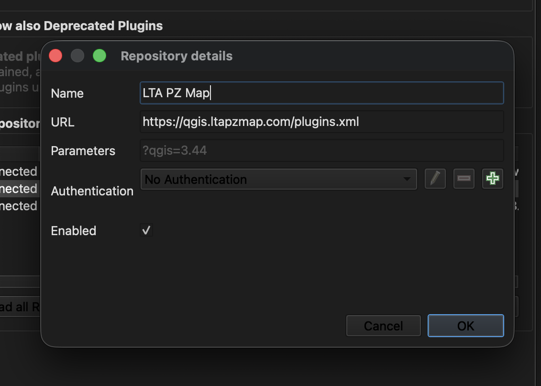
LTA PZ Map is distributed from a self-hosted plugin repository, so the first step is telling QGIS where to find it.
- In QGIS, open Plugins → Manage and Install Plugins…
- Click the Settings tab on the left.
- Under Plugin Repositories, click Add….
- Give it any name (e.g.
LTA PzMap) and paste this URL into the URL box:
https://qgis.ltapzmap.com/plugins.xml
- Click OK.
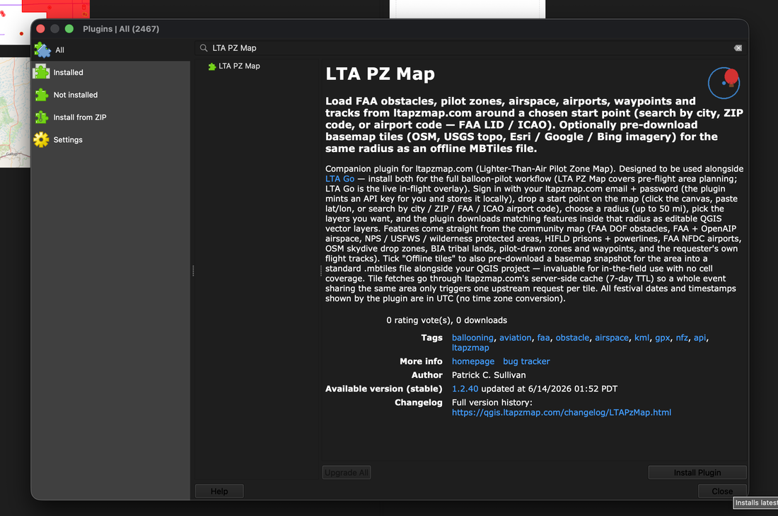
Now switch to the All tab, type LTA PZ Map in the search box, select it, and click Install Plugin.
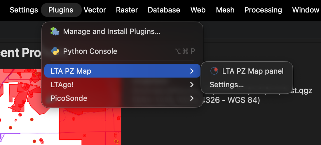
When it finishes you'll see a small balloon icon in the toolbar and a new LTA PZ Map entry under the Plugins menu. Click either one to open the side panel (the "dock").
2. Sign in
The plugin pulls data from your ltapzmap.com account, so you sign in once with the same email and password you use on the website.
The first time you open the dock with no account configured, the Sign in window opens automatically. (You can reopen it any time with the Settings… button at the top of the dock.)
Enter your email and password and click Sign in.
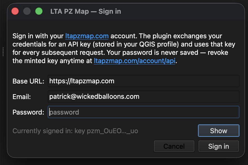
Behind the scenes the plugin exchanges your login for an API key and stores that key locally — your password is never saved. You can revoke the key any time at https://ltapzmap.com/account/api.
Once you're signed in, the top of the dock shows which account is active and the Load layers button becomes available.
Don't have an account? ltapzmap.com is free for balloon pilots.
Sign up, verify your email, then come back and sign in here.
3. Choose a start point
Everything the plugin downloads is centered on a single start point. There are four ways to set one — use whichever is easiest.
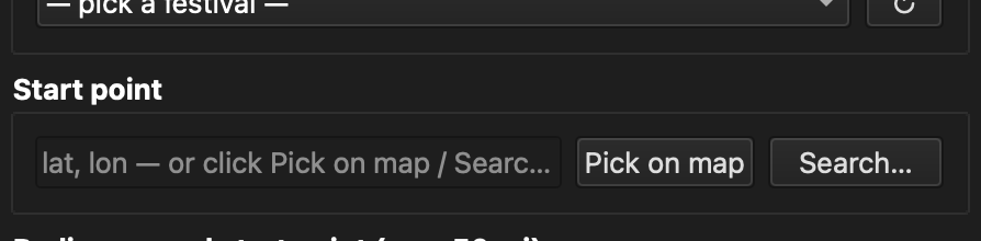
- Pick on map — click the button, then click anywhere on the QGIS
map canvas. The coordinate box fills in automatically.
- Type or paste a
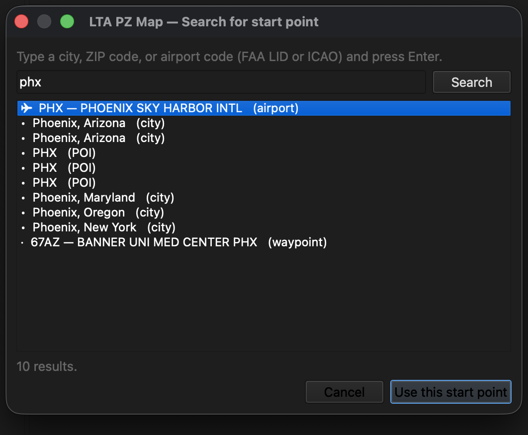
lat, londirectly (e.g.35.0844, -106.6504). - Search… — look up a place by city name, ZIP code, or airport code
(FAA identifier like ABQ or ICAO like KABQ). Pick a result and the start point is set for you.
- Festival — see the next section.
4. Pick a festival (optional)
If you're flying an event, the Festival dropdown is the fastest way to set up. It lists every upcoming festival on ltapzmap.com.
Choose one and the plugin **locks the start point to the festival's center** and suggests a radius that covers the event area. The manual start-point controls grey out — you don't need them, the center comes straight from the festival. You can still change the radius to pull a tighter or wider circle around that center.
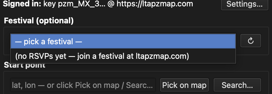
Click the ↻ button next to the dropdown to refresh the list if you just signed up for a new event. Pick the blank — pick a festival — row to unlock the start point and choose your own again.
5. Set the radius
Set how far out from the start point to pull data — this works whether you picked a festival (radius around its center) or set your own start point. The maximum is 50 miles. You can switch the unit between mi, km, and nm.
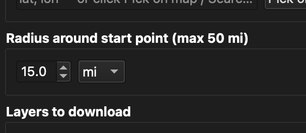
Bigger radius = more data and a longer download. For most pre-flight planning, 15–25 miles is plenty.
6. Choose which layers to download
Tick the layers you want. All and None buttons select or clear everything at once.
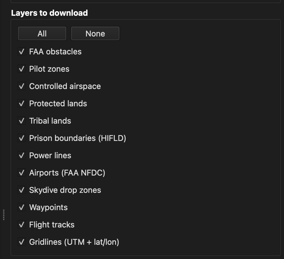
Available layers:
- FAA obstacles — towers, antennas, buildings (FAA DOF + OpenAIP), with height data
- Pilot zones — pilot-drawn no-fly zones, event boundaries, landing zones
- Controlled airspace — FAA Class B/C/D/E, Special Use Airspace, TFRs, OpenAIP worldwide
- Protected lands — NPS parks, USFWS refuges, federal Wilderness
- Tribal lands — BIA + Census + ancestral territories (situational awareness only)
- Prison boundaries — HIFLD correctional facilities
- Power lines — HIFLD high-voltage + OSM distribution
- Airports — FAA NFDC public airports
- Skydive drop zones — active jumping is a real conflict for balloons
- Waypoints — pilot-drawn pins (launch sites, propane, LZs)
- Flight tracks — your own recorded GPS trails
- Power plants — EIA generating stations (all / ≥500 MW / nuclear)
- Industrial sites — substations, landfills, quarries, strip mines, military installations
- Zoos — ~800 US zoos & animal parks (AC 91-36D: stay 2,000+ ft AGL over wildlife)
- UAS Facility Map + DROTAMs — FAA LAANC grid showing drone-permissible ceilings (0–400 ft AGL) per cell, plus drone NOTAMs
- Historical flights — famous balloon flights from 1783 to today, with launch/landing pins and tracks
- Gridlines — UTM (1 km) and lat/lon grids, generated locally
7. Display options
Two settings tune how the data looks once loaded:
- Max features per layer — caps how many features each layer pulls.
Raise it for dense areas, lower it to keep things light.
- Label font size — the size of the name labels drawn on the map.
Changing this updates already-loaded labels immediately.
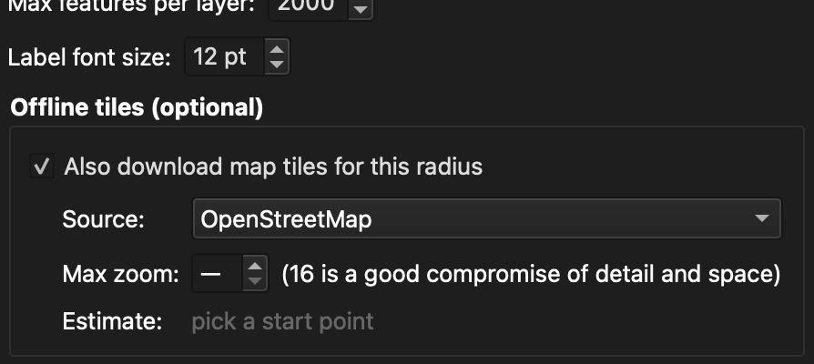
8. Offline tiles (optional)
Tick Also download map tiles for this radius to save a basemap to your computer so the map still works with no internet — perfect for in-the-field use from the basket or chase vehicle.
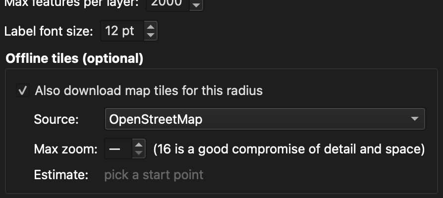
- Source — choose OpenStreetMap, USGS topo, satellite imagery
(Esri / Google / Bing), or MapTiler.
- Max zoom — how much detail. 16 is a good balance of detail and
file size; higher zooms grow the download quickly.
The tile count and rough size estimate update as you change settings, so you know what you're committing to before you start. Re-loading the same area only downloads tiles you don't already have.
9. Load everything
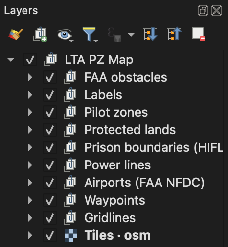
Click Load layers. The plugin downloads your chosen layers (and tiles, if enabled) and adds them to QGIS under a group called **LTA PZ Map**.
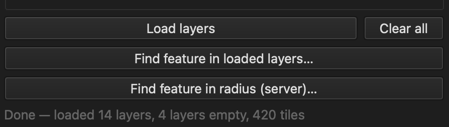
When it's done, the layer panel shows the LTA PZ Map group with each data type in its own subgroup, plus Labels and Gridlines subgroups. Everything starts collapsed so the panel stays tidy.
Tip: Save your QGIS project (Project → Save) so the layers
come back next time you open it. All the data files are saved right
next to your project file.
10. Find a feature
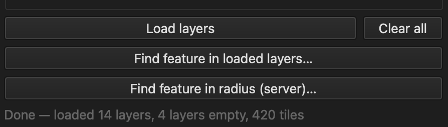
Two search buttons help you locate something specific:
- Find feature in loaded layers… — searches the data you've already
loaded. Type a name, pick a result, and the map zooms to it and highlights it.
- Find feature in radius (server)… — searches the full ltapzmap.com
database within your current area, including layers you haven't loaded yet. The map pans to whatever you pick.
11. Clear everything
Clear all removes every layer the plugin added and deletes the data files it created. Use it to start fresh — it only touches the plugin's own layers, never anything else in your project.
Tips & troubleshooting
- Labels overlapping? Zoom in — the map automatically thins out
labels when zoomed out so they stay readable.
- Toggling labels off — the Labels subgroup holds all the name
labels. Untick it to hide every label at once.
- Layers missing after reopening a project? Make sure you saved the
project after loading (so the file paths are recorded). On the latest plugin version, data files are saved next to your project and survive restarts.
- Re-download is slow / re-fetching tiles? Update to the latest
plugin version — re-loading the same area now skips tiles you already have.
- Need to update the plugin? **Plugins → Manage and Install →
Installed → LTA PZ Map → Upgrade Plugin.**
Companion to ltapzmap.com and the in-flight overlay LTA Go. Built for the balloon community.